Collections
Item
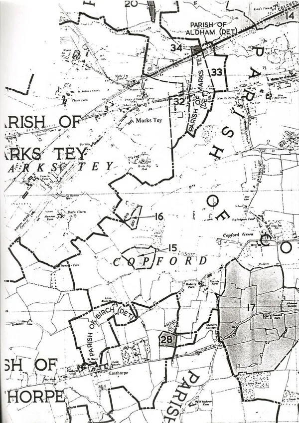
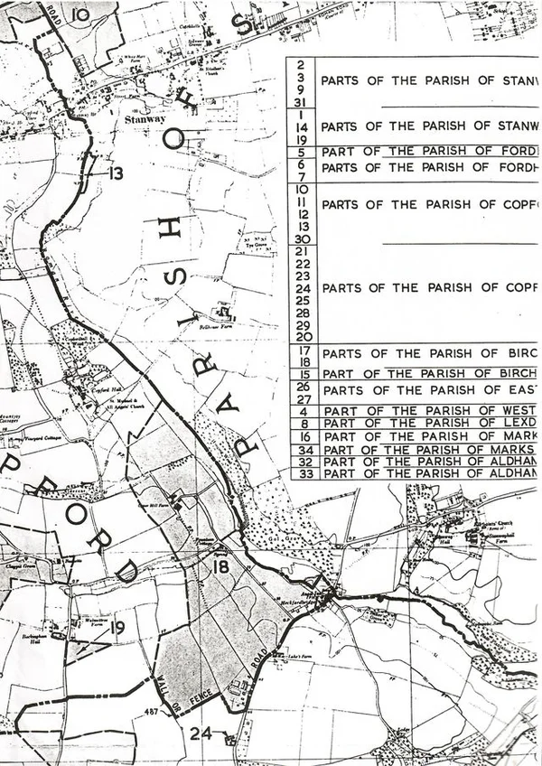
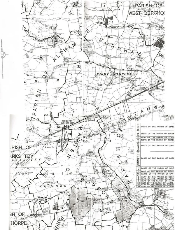
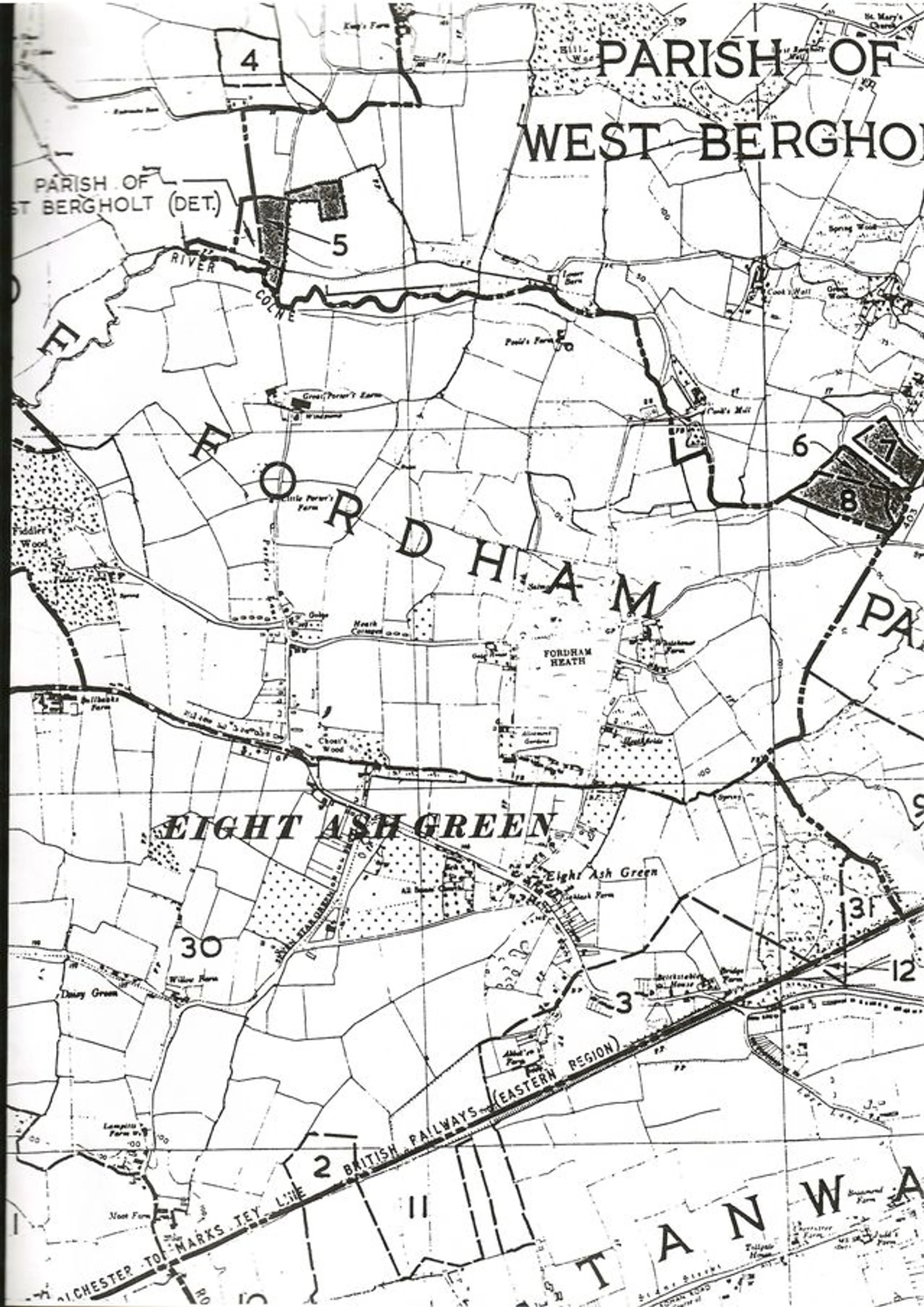
St Andrew's Church parish boundary map 2
Object type
Date
1960
Description
Section of a map delineating the new parish boundary, showing Fordham, Eight Ash Green, West Bergholt and Stanway, 1960.
Credit
© Marks Tey Archive
Usage
CC-4.0, view usage statement
Provenance
Andrew Waters
Archive code
MTHP.1.3.3.1.1.4